Priemyselná
Rozloženie podnikov podľa odvetvia v Saint-Esprit
Fakty o Saint-Esprit
| plocha | 19.7 km² |
| Počet obyvateľov | 9 540 |
| Obyvateľstvo mužov | 4 524 (47.4%) |
| Ženská populácia | 5 016 (52.6%) |
| Zmena populácie (1975 to 2020) | +65.2% |
| Zmena populácie (2000 to 2020) | +16.4% |
| Priemerný vek | 40.7 rokov (Muži: 39.8, Ženy: 41.4) |
| Miestny čas | |
| Časová zóna | atlantický štandardný čas |
| Súradnice | 14.55000, -60.93333 |
| PSČ | 97270 |
Mapa Saint-Esprit
Interaktívna mapa
Populácia Saint-Esprit
Roky 1975 až 2020
| Data | 1975 | 1990 | 2000 | 2015 | 2020 |
|---|---|---|---|---|---|
| Počet obyvateľov | 5 776 | 7 066 | 8 193 | 9 214 | 9 540 |
| Hustota obyvateľstva | 293,4 / km² | 358,9 / km² | 416,2 / km² | 468 / km² | 484,6 / km² |
Zmena populácie Saint-Esprit od 2000 do 2015
Nárast o 12.5% od roku 2000 do 2015
| Miesto | Zmena od roku 1975 | Zmena od roku 1990 | Zmena od roku 2000 |
|---|---|---|---|
| Saint-Esprit | +59.5% | +30.4% | +12.5% |
| Martinik | +20.6% | +11.1% | +2.7% |
Medián veku Saint-Esprit
Medián veku: 40.7 rokov
| Miesto | Priemerný vek | Stredný vek (žena) | Stredný vek (muž) |
|---|---|---|---|
| Saint-Esprit | 40.7 yrs | 41.4 yrs | 39.8 yrs |
| Martinik | 39.5 yrs | 40.4 yrs | 38.1 yrs |
Hustota populácie Saint-Esprit
Hustota populácie: 485 / km²
| Miesto | Počet obyvateľov | plocha | Hustota |
|---|---|---|---|
| Saint-Esprit | 9 540 | 19,7 km² | 485 / km² |
| Martinik | 358 325 | 1 142,9 km² | 314 / km² |
Historická a predpokladaná populácia Saint-Esprit
Odhadovaná populácia od 1200 do 2100
- JRC (European Commission's Joint Research Centre) práca na GHS built-up grid
- CIESIN (Center for International Earth Science Information Network)
- [odkaz] Klein Goldewijk, K., Beusen, A., Doelman, J., and Stehfest, E.: Anthropogenic land use estimates for the Holocene – HYDE 3.2, Earth Syst. Sci. Data, 9, 927–953, https://doi.org/10.5194/essd-9-927-2017, 2017.
Rozloženie cien
Obchodná distribúcia do ceny pre Saint-Esprit
Index ľudského rozvoja (HDI)
Štatistický zložený index strednej dĺžky života, vzdelania a príjmu na obyvateľa.
Emisie CO2 Saint-Esprit
Emisie oxidu uhličitého (CO2) na obyvateľa v tonách za rok
| Miesto | Emisie CO2 | Emisie CO2 na obyvateľa | Intenzita emisií CO2 |
|---|---|---|---|
| Saint-Esprit | 57,333 tn | 6.01 tn | 2,912.1 tons/km² |
| Martinik | 1,925,583 tn | 5.37 tn | 1,684.9 tons/km² |
| Emisie CO2 v roku 2013 (tony/rok) | 57,333 tn |
| Emisie CO2 v roku 2013 (tony/rok) na obyvateľa | 6.01 tn |
| Intenzita emisií CO2 v roku 2013 (tony/km²/rok) | 2,912.1 tons/km² |
Riziko prírodných rizík
Relative risk out of 10
| Nebezpečenstvo | Risk Level |
|---|---|
| Earthquake | Medium (6) |
| Cyclone | Medium (5) |
* Risk, particularly concerning flood or landslide, may not be for the entire area.
- Dilley, M., R.S. Chen, U. Deichmann, A.L. Lerner-Lam, M. Arnold, J. Agwe, P. Buys, O. Kjekstad, B. Lyon, and G. Yetman. 2005. Natural Disaster Hotspots: A Global Risk Analysis. Washington, D.C.: World Bank. https://doi.org/10.1596/0-8213-5930-4.
- Center for Hazards and Risk Research - CHRR - Columbia University, Center for International Earth Science Information Network - CIESIN - Columbia University, International Bank for Reconstruction and Development - The World Bank, and United Nations Environment Programme Global Resource Information Database Geneva - UNEP/GRID-Geneva. 2005. Global Cyclone Hazard Frequency and Distribution. Palisades, NY: NASA Socioeconomic Data and Applications Center (SEDAC). https://doi.org/10.7927/H4CZ353K.
- Center for Hazards and Risk Research - CHRR - Columbia University, Center for International Earth Science Information Network - CIESIN - Columbia University. 2005. Global Earthquake Hazard Distribution - Peak Ground Acceleration. Palisades, NY: NASA Socioeconomic Data and Applications Center (SEDAC). https://doi.org/10.7927/H4BZ63ZS.
Nedávne zemetrasenia v okolí
Hodnota 3,0 a vyššia
| Dátum▼ | Čas↕ | Magnitude↕ | Distance↕ | hĺbka↕ | Miesto↕ | odkaz |
|---|---|---|---|---|---|---|
| 7/24/19 | 5:05 PM | 3.1 | 43.5 km | 33,510 m | 21km NW of Gros Islet, Saint Lucia | usgs.gov |
| 7/27/18 | 1:02 AM | 4.2 | 16.2 km | 157,690 m | 7km SSW of Les Trois-Ilets, Martinique | usgs.gov |
| 12/16/16 | 7:51 PM | 4.3 | 48.7 km | 166,500 m | 8km NW of Basse-Pointe, Martinique | usgs.gov |
| 12/28/15 | 6:55 AM | 5.6 | 46 km | 150,000 m | 20km WSW of Saint-Pierre, Martinique | usgs.gov |
| 3/1/15 | 10:34 AM | 3.2 | 46.5 km | 69,200 m | 32km ENE of Petite Riviere Salee, Martinique | usgs.gov |
| 4/9/14 | 8:50 PM | 4.6 | 43.9 km | 84,350 m | 34km ESE of Le Marin, Martinique | usgs.gov |
| 2/9/14 | 10:54 AM | 4.3 | 31 km | 16,800 m | 21km ESE of Le Vauclin, Martinique | usgs.gov |
| 1/19/13 | 9:18 AM | 3.7 | 34.5 km | 75,100 m | Martinique region, Windward Islands | usgs.gov |
| 9/26/12 | 6:15 PM | 4.3 | 47.3 km | 169,600 m | Martinique region, Windward Islands | usgs.gov |
| 3/4/12 | 1:25 AM | 4 | 35.4 km | 119,500 m | Saint Lucia region, Windward Islands | usgs.gov |
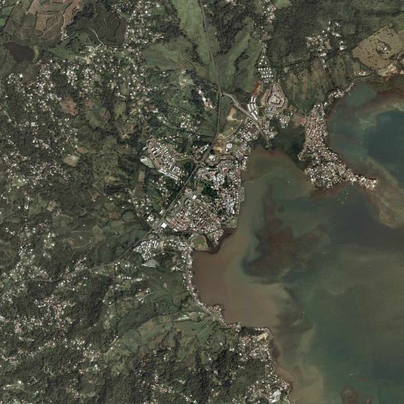
Saint-Esprit
Saint-Esprit je francúzska obec, ktorá sa nachádza v zámorskom departemente a zámorskom regióne Martinik.
Saint-Esprit stránka Wikipédia

O našich údajoch
Údaje na tejto stránke sú odhadované pomocou rôznych verejne dostupných nástrojov a zdrojov. Sú poskytované bez záruky a môžu obsahovať nepresnosti. Používajte na vlastné riziko.